

The Evidence Pack
Standardized Outputs for Defensible Decisions
Stop managing by "gut feel." Start managing with repeatable evidence. Traditional vegetation reports are often "black boxes", static maps, or spreadsheets that lack the underlying proof required for high-stakes compliance. The POLLi Evidence Pack converts raw, high-resolution imagery into a governed, shared evidence standard that remains comparable over time.

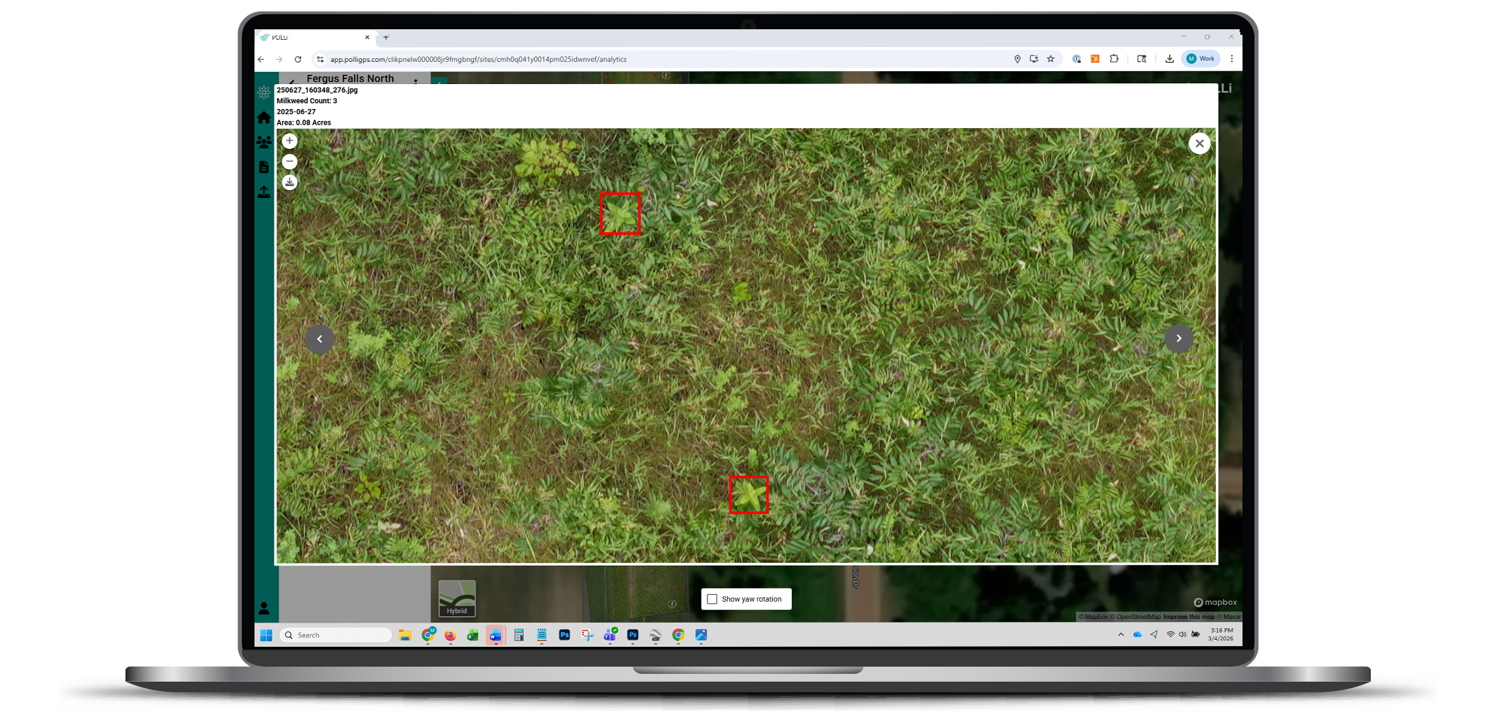
Image-Linked Lineage: The End of "Black Box" Data
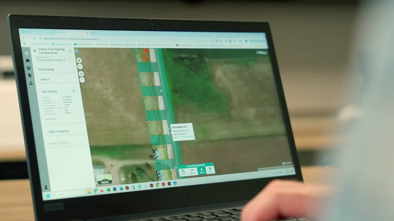
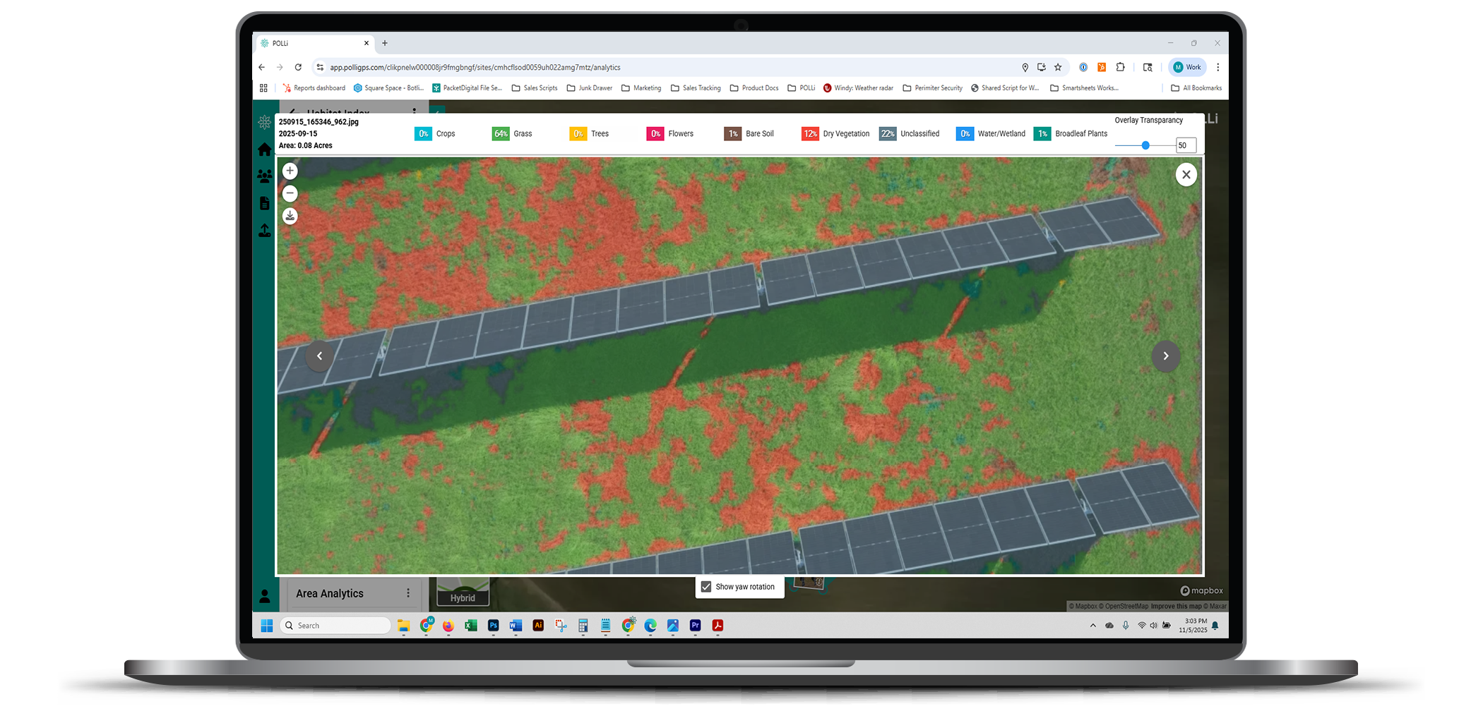
Every detection, classification, and finding in a POLLi report is permanently anchored to its source high-resolution evidence photo.
Traceable: One click takes you from a spreadsheet row or GIS point to the exact image frame where the observation was made.
Verifiable: Field-to-office transparency allows stakeholders to manually verify findings without needing to re-inspect the corridor.
Complete: Maintain a full record of the visual truth, providing an audit-ready "digital thread" for your entire Right-of-Way.
Version-Controlled Deliverables
In a changing landscape, your data shouldn't be a moving target. POLLi delivers findings as versioned Evidence Packs.
Consistent Comparisons: By using a fixed version of the Governed Shared Evidence Standard, you can compare results across seasons or years without "interpretation drift."
Audit Readiness: Every report represents a stable, defensible snapshot of your assets at a specific point in time, protecting your organization from the risks of fluctuating algorithms.
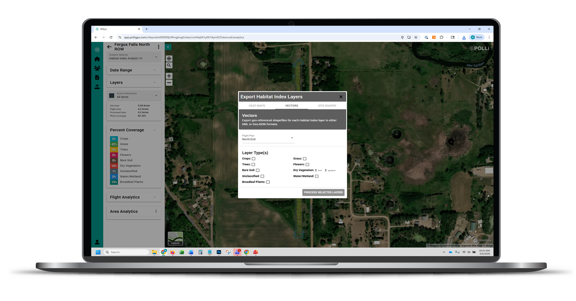
GIS-Ready Integration (The Digital Thread)
The value of evidence is only realized when it reaches the people who need it.
Enterprise Compatible: Export findings directly into your Enterprise GIS or Asset Management systems.
Standardized Schema: Our outputs use a consistent data structure, ensuring your vegetation findings speak the same language as your physical asset data.
Standardized Stewardship & Compliance Reporting
Whether you are reporting to a regulator, a landowner, or a conservation partner, POLLi provides a professional, visual output that builds trust.
Stewardship Records: Document the presence of beneficial species or habitat quality with the same rigor used for safety inspections.
Contractor Alignment: Use the Evidence Pack to align contractor performance with defined standards, ensuring that what was paid for in the field is clearly visible in the data.
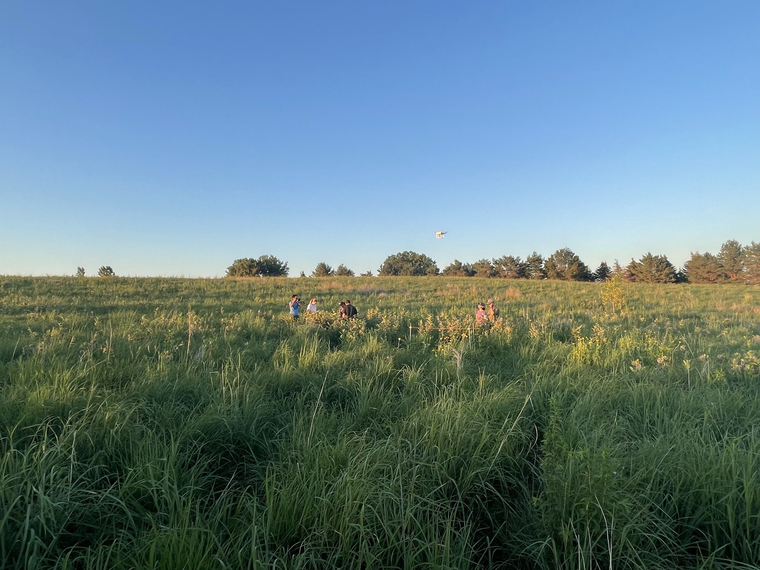

Our mission is to make field data collection fast, easy, and robust. We want to put drones and artificial intelligence in your organization’s toolbox.

Multiple, In-depth Reports Available
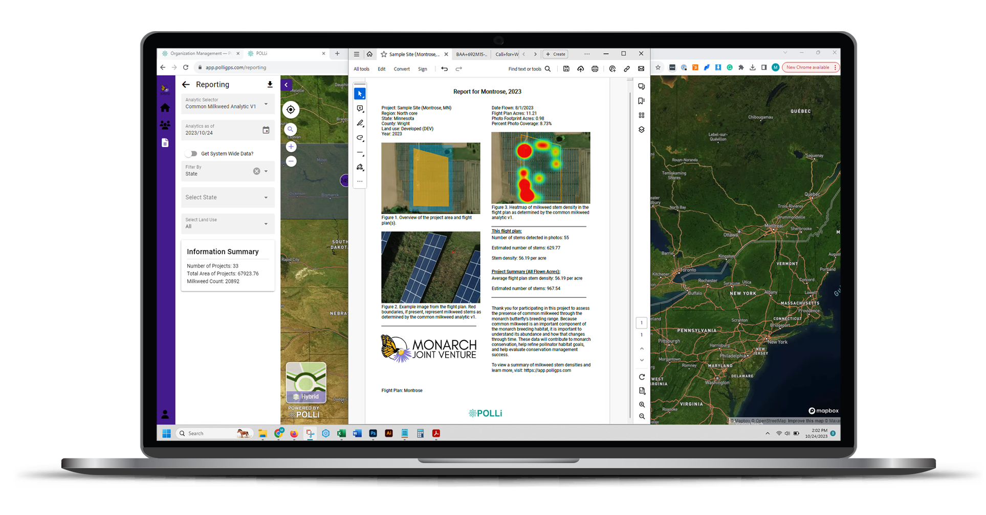
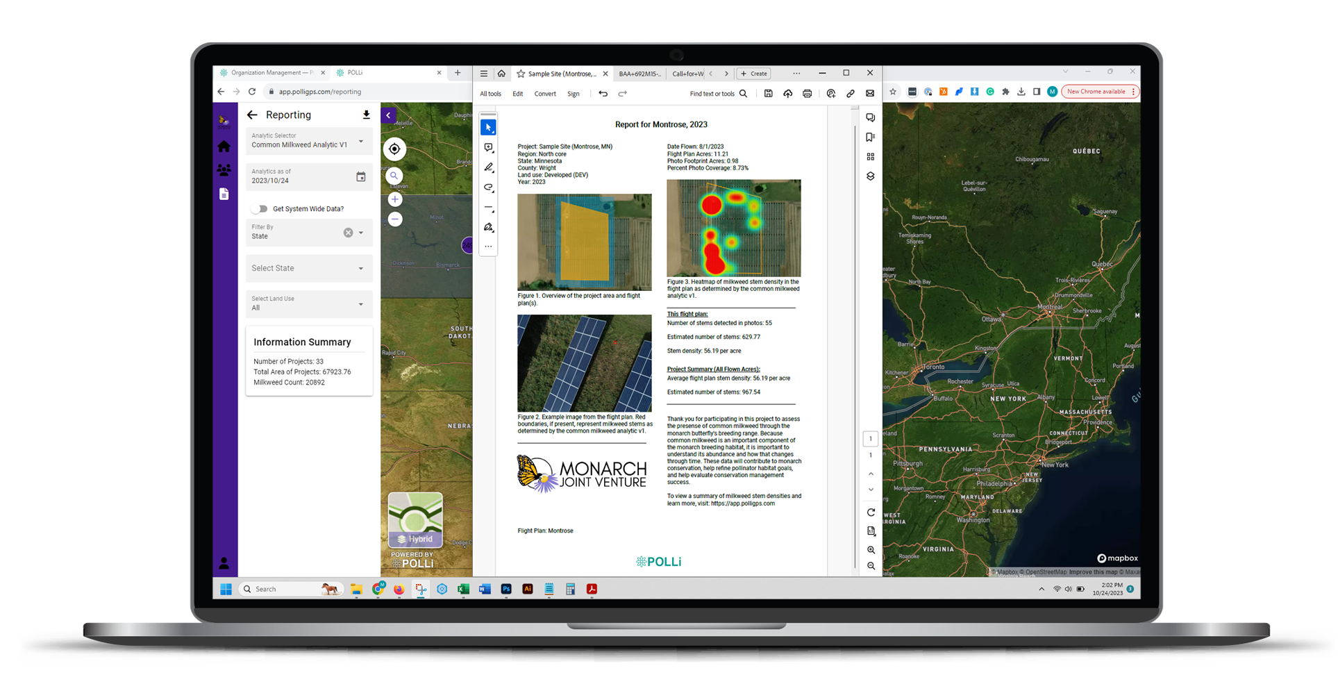
Our initial reporting was driven by our conservation partners during development. The aim was to give the users all the information they needed to report and track conservation progress, as well as deliver high-quality reports to landowners.
Polli Data Viewer
Spreadsheets
Landowner’s Report (PDF)
Heatmaps
Image exports
GeoJSON and KMLs of sites, flights, custom areas, and identified objects.
More (seriously, ask us what you need, and we can probably build it)
The reports you need - fast
